The Conversation (0)
Science & Tech
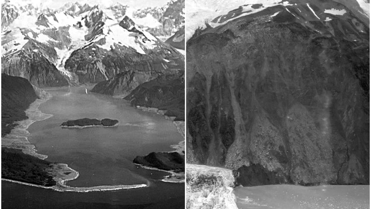
From left: Lituya Bay in Alaska where the megatsunami hit back in 1958; A photo taken in the aftermath shows some of the scars left behind
Water furiously lashing the top of the Empire State Building might sound like the stuff of dystopian sci-fi blockbusters but, in reality, it’s not beyond the realms of possibility.
Because, you see, our oceans have already spawned waves that were taller than some of the world’s great landmarks.
Indeed, the largest tsunami on record, which pounded southeastern Alaska back in 1958, was so huge that its effects can still be seen from space more than six decades on.
The apocalyptic wave, which reached up to 1,720 feet (524 metres) high, smashed through the narrow fjord of Lituya Bay after a 7.8 earthquake struck a nearby tectonic boundary called the Fairweather Fault.
The quake triggered a major landslide which sent 90 million tons of rock plunging into the bay, according to NASA’s Earth Observatory.
Eyewitnesses described hearing, and feeling, an explosive boom, as a shattered glacier soared hundreds of feet into the air. Then the megatsunami, studded with huge chunks of ice, roared through the bay.
One fisherman, named Howard Swanson, documented how his boat was lifted so high on the crest of the wave that he found himself looking down upon a forest of trees below him.
Tragically, a couple who were fishing when the wall of water hit weren’t so lucky – their boat was crushed and neither made it out alive.
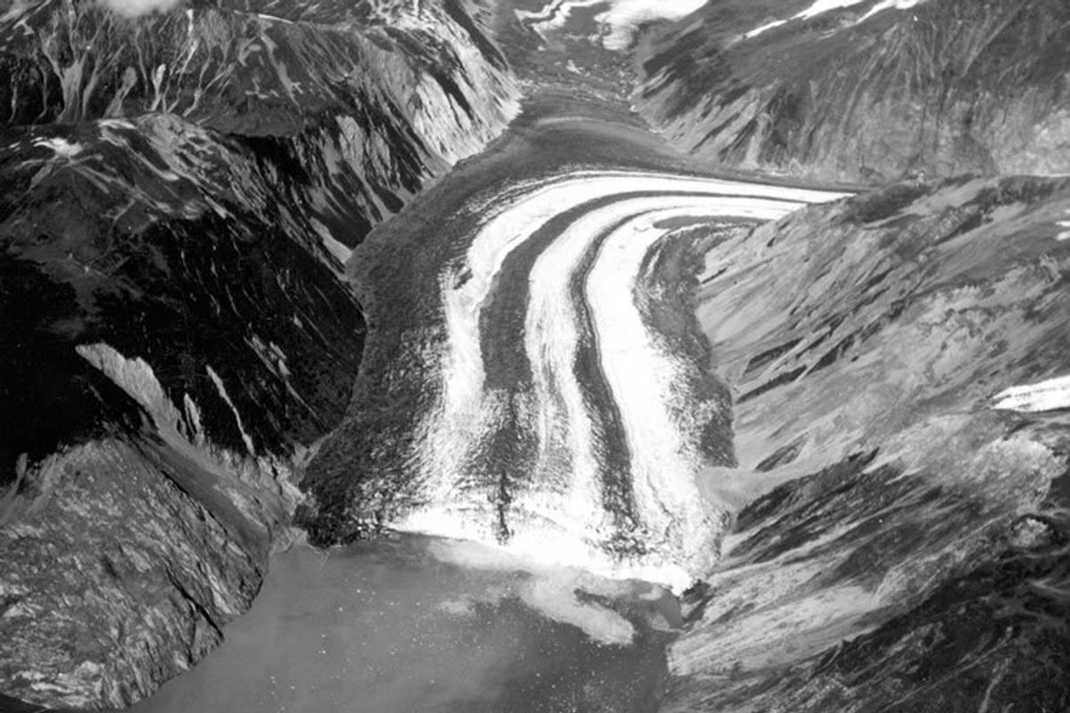 A view of the Fairweather Fault Trench at the head of Lituya Bay following the 1958 disaster(D.J. Miller, United States Geological Survey)
Experts believe that the devastating phenomenon, which killed five people in total, was largely caused by the toppling of a mountain peak.
As the 7.8 earthquake shook the surrounding landscape, a chunk – measuring around 2,400 feet by 3,000 feet by 300 feet – dislodged from the top of a cliff, dropping 2,000 feet down into the bay.
“In some respects, [this] created a similar reaction to that which would have occurred if an asteroid had fallen into the water,” the Western States Seismic Policy Council wrote in a summary of the catastrophe.
This, to refer back to our Hollywood blockbuster-inspired image, is 270 feet taller than the Empire State Building.
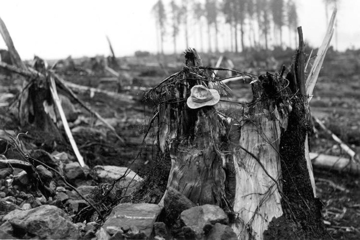 The stump of a living spruce tree that was torn off by the megawave(D.J. Miller, United States Geological Survey)
Now, 65 years on from the disaster, the scars remain.
When the tsunami hit, it scoured away almost all of the Lituya forest’s vegetation – ripping millions of trees from its banks.
The ring of damage is still visible across the shoreline, where new trees eventually began growing to replace their lost ancestors.
Thanks to this war wound imprinted on the bay, experts were able to deduce that the tsunami’s waves stretched between 700 feet (200m) and 1,720 feet (524 metres) tall – making it the biggest ever recorded.
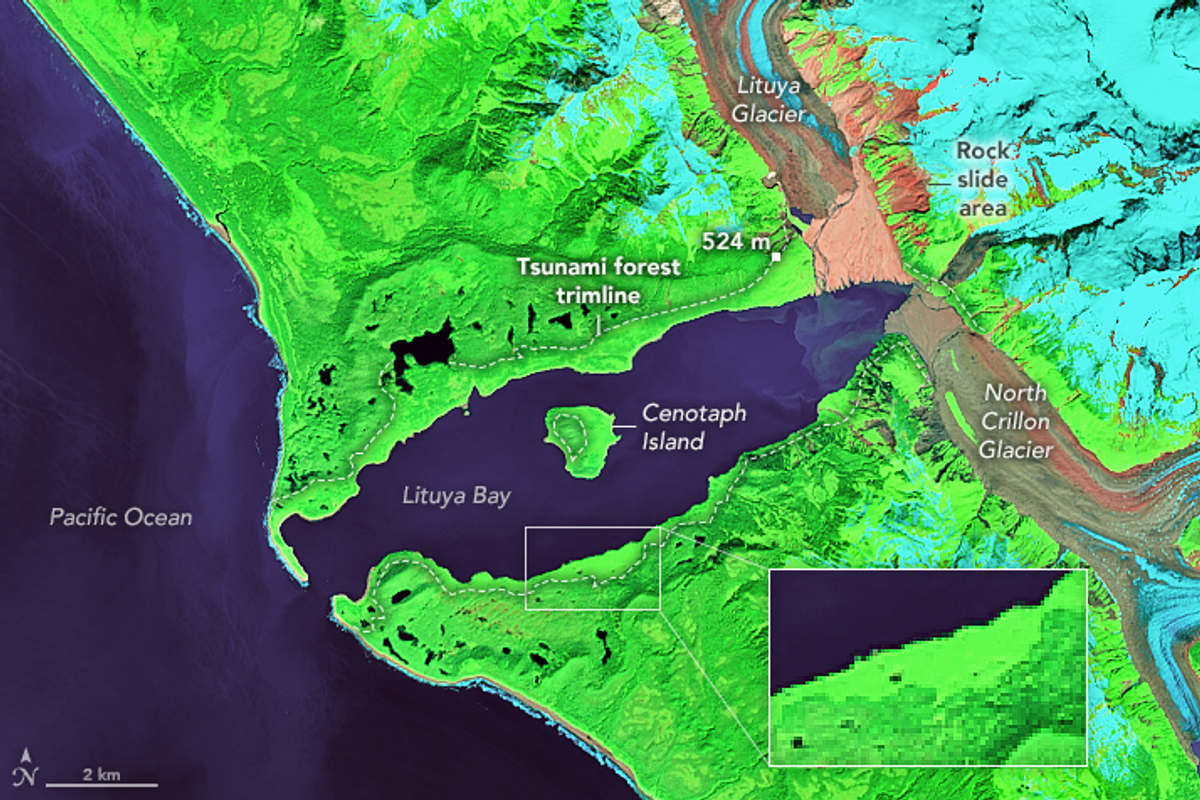 This false-colour satellite image highlights where the damage line is still imprinted in the forest(NASA Landsat)
And whilst, no successor has come close to snatching this record, Lituya Bay is primed for further water monsters.
According to NASA, its steep walls, the U shape of its seafloor and its position on a tectonic hotspot suggest it will host more megatsunamis in future.
All we can do now is try to learn from the past and make sure we’re well equipped to face whatever the future has in store.
Sign up for our free Indy100 weekly newsletter
Have your say in our news democracy. Click the upvote icon at the top of the page to help raise this article through the indy100 rankings