Harriet Brewis
Jun 05, 2024

The island of Bermeja appeared on maps and in official documents for almost 500 years before 'vanishing'
(Google Maps/iStock)
History abounds with stories about long-lost countries and civilisations, and yet, few of these legendary lands actually had tangible addresses.
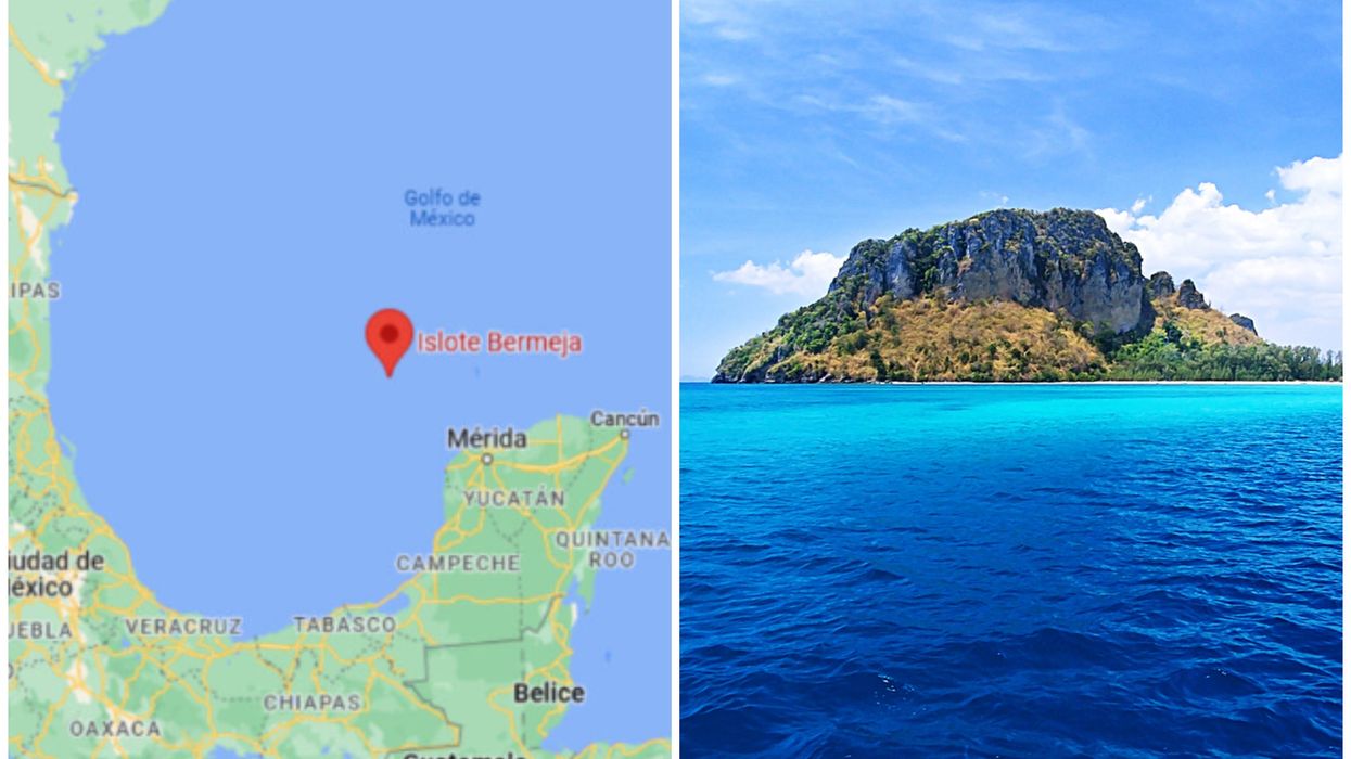
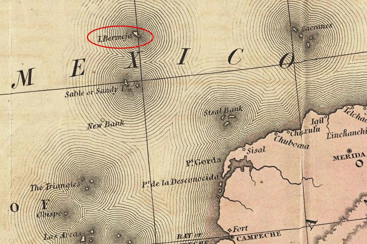
However, this was not the case for the island of Bermeja which, for centuries, was a common feature on maps drawn up by Spanish explorers.
First appearing in a compendium of the islands of the world in 1539, the tiny territory off Mexico’s Yucatán Peninsula was an established cartological fixture until the 18th century.
But, in 1921, it made its last mapped appearance (in the Geographic Atlas of the Mexican Republic), after which it seemingly vanished from the ocean altogether.
So what ever happened to this elusive landmass? And did it ever exist at all?

There are a number of theories surrounding its fate – some more credible than others.
Some speculate that the uninhabited island was simply swallowed up by the surrounding waters as the result of natural shifts in the ocean floor and rising sea levels.
Others suggest that it was a fabrication – either the result of mistaken observations by cartographers or cunningly invented by early explorers to deceive their rivals.
While others posit that it was, in fact, deliberately blown up by the CIA.
The latter, and most controversial, of these hypotheses stems from a dispute over oil.
Between 2008 and 2009, the US and Mexican governments conducted a series of negotiations over who had drilling rights to part of the Gulf of Mexico, in which Bermeja was once said to lie.
“Isla Bermeja was a controversy because it was a key area of the Exclusive Economic Zone in the Gulf of Mexico,” geographer Israel Baxin Martínez explained in a 2021 interview with Mexico News Daily.
“There were official searches around this time to see if there was some remnant of this island because the expansion of this zone for Mexico would mean an abundance of oil.”
However, these searches proved fruitless, and in failing to prove Bermeja’s existence, Mexico lost the rights to a maritime area that was believed to hold 22.5 billion barrels of oil.
Given what was at stake here, it is now a popular rumour among Yucatán fishing communities that the island was intentionally destroyed to allow America to eat into the Exclusive Economic Zone, Mexico News Daily reports.
And whilst this is, of course, a largely baseless conspiracy theory, in 2008, six senator’s from Mexico’s then governing National Action Party voiced their suspicions that the island had been made to vanish by US powers.

Still, this is a pretty far-fetched idea when you consider what it would take to decimate an entire island. After all, surely someone would notice?
Furthermore, this wouldn’t be the first time that maps have proved misleading.
Julio Zamora, president of the Mexican Society of Geography, pointed out in a 2010 interview with Lonely Planet: “Countries making maps in the 16th and 17th centuries published them with inaccuracies to prevent their enemies from using them.”
After all, a strategically placed (fake) island could dissuade prospective usurpers from approaching a particular area.
Moreover, as Martinéz noted: “We notionally believe that everything that is mapped must exist. So, because the island was mapped in the 16th, 17th, and 18th centuries, the assumption was that the island existed, and the map record confirms it.”
Nevertheless, when it comes to Bermeja, things are a little more complex. Because not only was the island added to maps, it was also mentioned in other documents.
These included a number of government and other official inventories published towards the end of the 19th and beginning of the 20th century — some of which were government inventories.
“The question with Bermeja in particular is that it’s not just mentioned in cartographic history,” Martínez said. “It has a much larger backlog of studies.”
Irasema Alcántara, from the Geography Institute at the Universidad Nacional Autónoma de México (UNAM), agreed, telling Lonely Planet: “We've encountered documents containing very precise descriptions of Bermeja's existence.
“On this basis we firmly believe that the island did exist, but in another location.”
Nevertheless, since 2009, only four official expeditions have been launched to find Bermeja, alongside a handful of journeys by journalists and amateur sleuths.
TV Azteca and the National Autonomous University both conducted maritime research campaigns to locate the island, but they came back empty-handed – not even finding vestiges of the land that may have once stood there.
Martínez pointed out that, if nothing else, the whole mystery sheds an interesting light on the human condition.
“Culturally, what we see with Bermeja, [...] is that people don’t care about what they’ve got, but they do care about what they’ve lost,” he reflected.
“People are jealous of what has been taken from them, but they refuse to do anything with what they already have.”
Sign up for our free Indy100 weekly newsletter
How to join the indy100's free WhatsApp channel
Have your say in our news democracy. Click the upvote icon at the top of the page to help raise this article through the indy100 rankings
Top 100
The Conversation (0)


