News
Matt Broomfield
Dec 08, 2015
Storm Desmond has brought record levels of rainfall to parts of Scotland and northern England, leaving emergency services and local authorities scrambling to repair flood damage.
It has been claimed that cuts to local government services left councils in Lancaster and Cumbria unable to afford adequate flood defences, leaving thousands at the mercy of the storm.
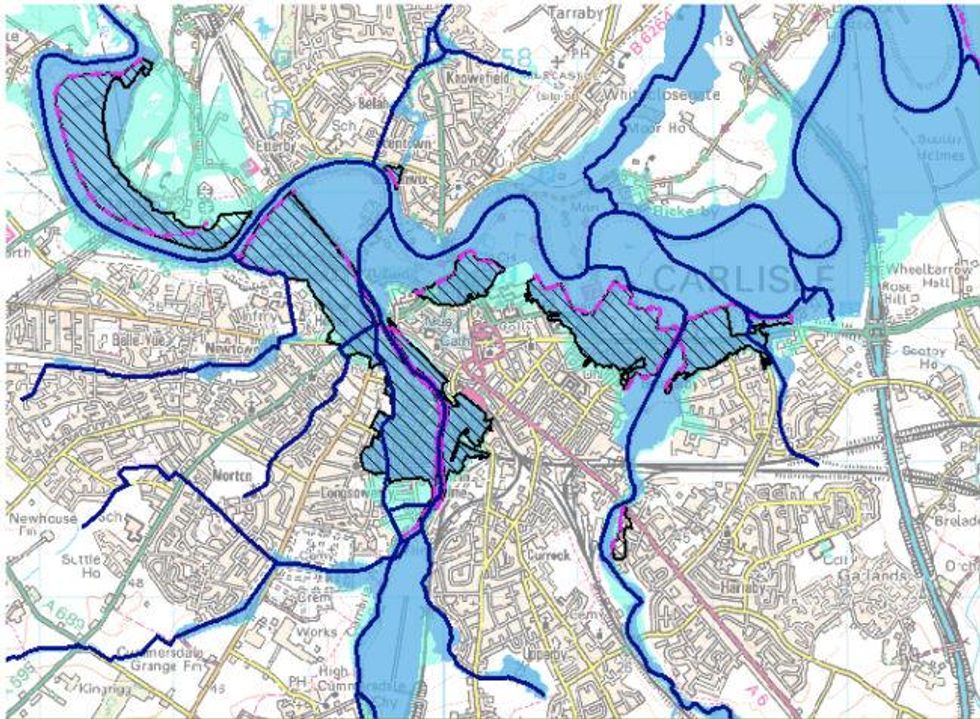
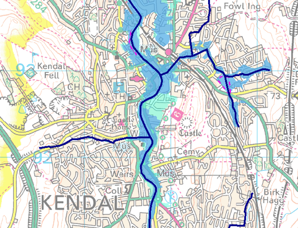
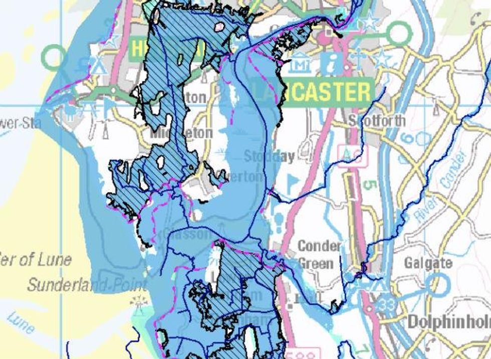
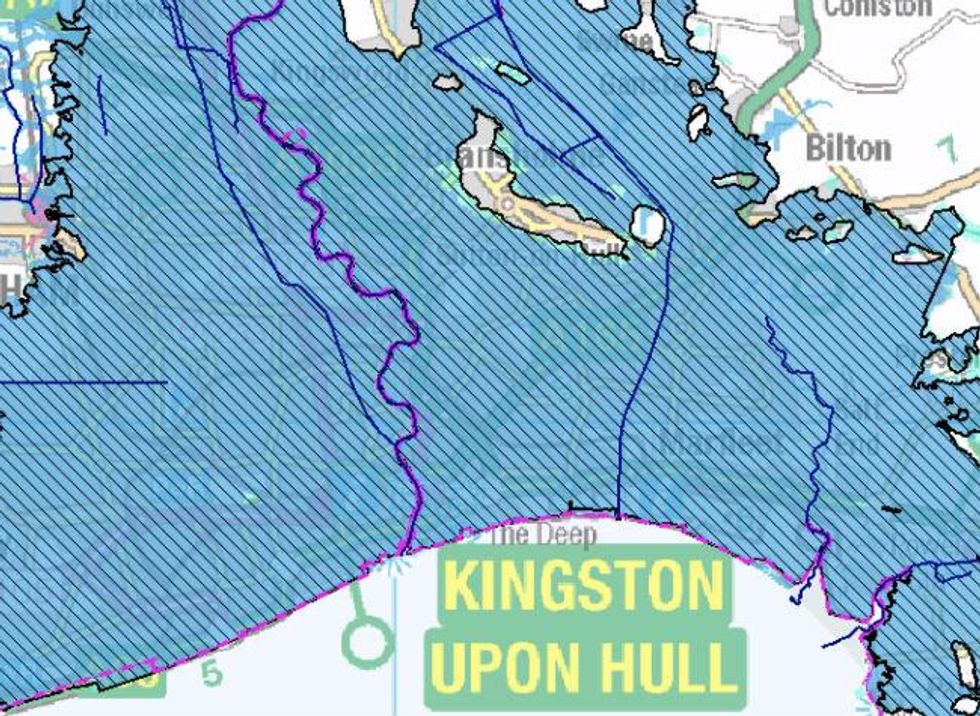
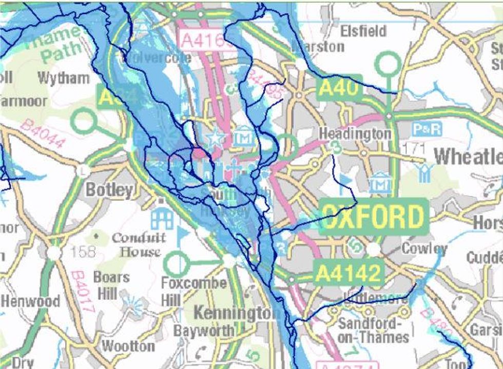
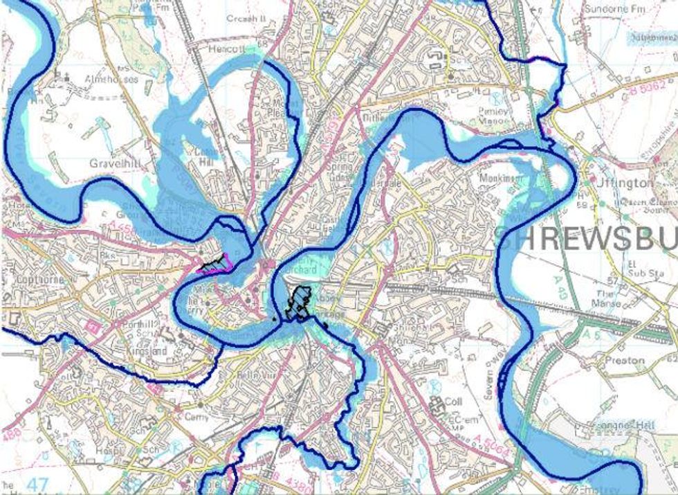
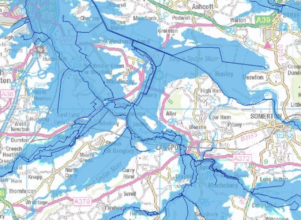
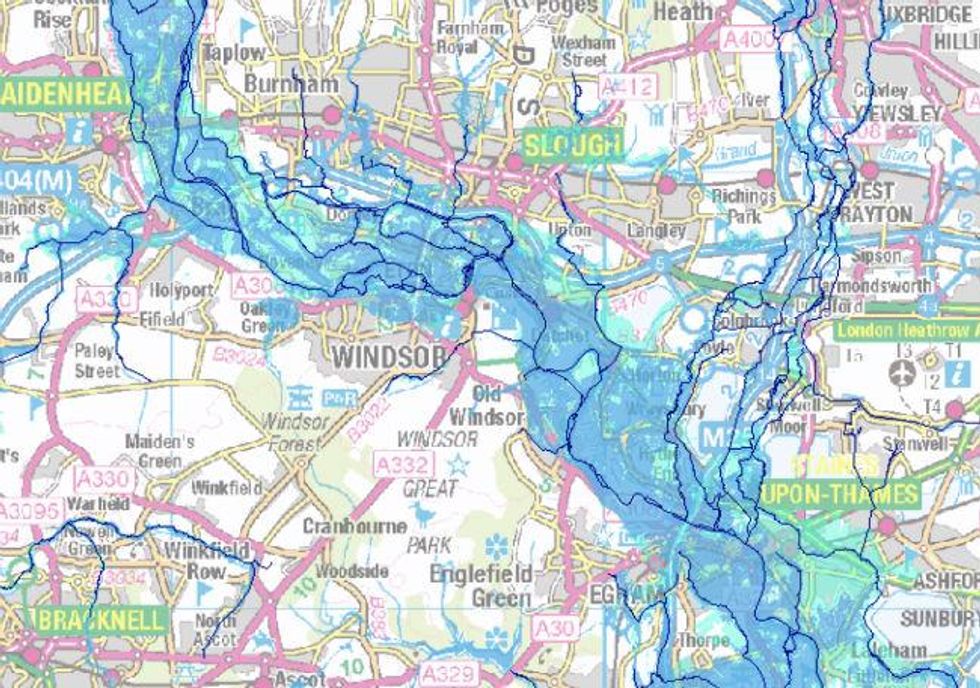
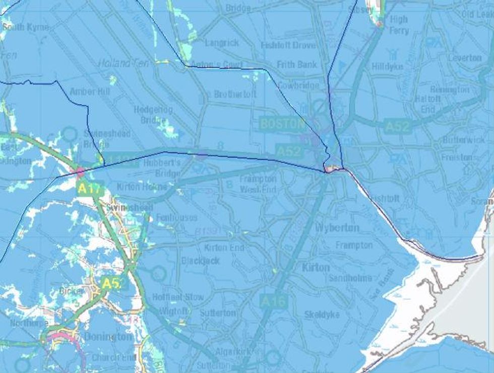
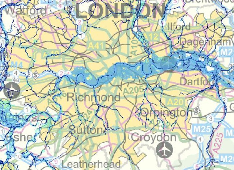
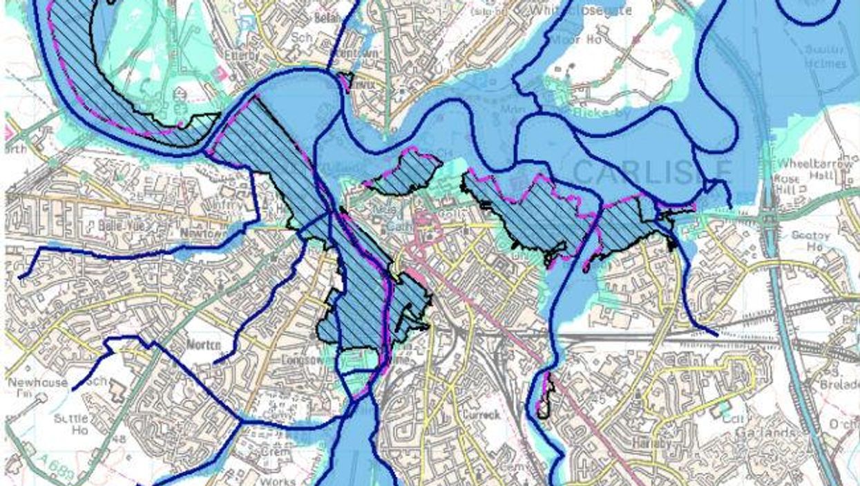
The Environment Agency maps below show which areas in England’s most flood-prone regions are at serious risk of flooding, and which are supposed to be protected by flood defences.
In any given year, houses in Flood Zone 3 stand either a one per cent chance of being flooded by a river or a 0.5 per cent chance of being flooded by the sea. Houses in Zone 2 stand a 0.1 per cent chance of being flooded by a river.
Carlisle (1:40,000)
Kendal (1:20,000)
Lancaster (1:75,000)
Kingston-Upon-Hull, (1:75,000)
Oxford (1:75,000)
Shrewsbury (1:40,000)
The Somerset levels (1:125,000)
Maidenhead, Slough and Staines-Upon-Thames (1:125,000)
Boston and East Lincolnshire (1:125,000)
London (1:300,000)
More: Severe flood warnings and thousands without power after Storm Desmond
Top 100
The Conversation (0)
