News
Greg Evans
Nov 21, 2018
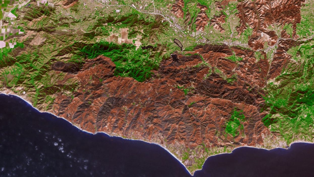
Picture:
Joshua Stevens/NASA/GSFC/METI/ERSDAC/JAROS/US/Japan ASTER Science Team
The devastating Woolsey Fire that ravaged Southern California was one of the most lethal wildfires that the United States has ever seen.
As of Tuesday, 98 per cent of the fire had been contained but the 97,000 acres that the fire burnt to the ground have left such a mark on the landscape that it can be seen from space.
A tweet posted by Nasa shows the massive amount of land that the fire covered and the extent of the damage it caused leaving behind a 'scar on the landscape.'
The pictures was taken using Nasa's Advanced Spaceborne Thermal Emission and Reflection Radiometer (ASTER), which is housed on the Terra satellite, on November 18.
Although Nasa admit that the colours in the image have been altered to look more natural it is still a shocking sight to behold.
The fire destroyed 1500 structures, damaged 341 others and also claimed three lives.
Nasa's online mapping tool the Rehabilitation Capability Convergence for Ecosystem Recovery (RECOVER) at Idaho State University will assist fire managers with their recovery efforts after the fire.
HT Mashable
More: Trump said other countries do a better job of cleaning 'the floors of the forest'

Top 100
The Conversation (0)


