The Conversation (0)
Picture:
Massimo Pietobon
Right now, it feels like the world is fused together by one common experience: a pandemic.
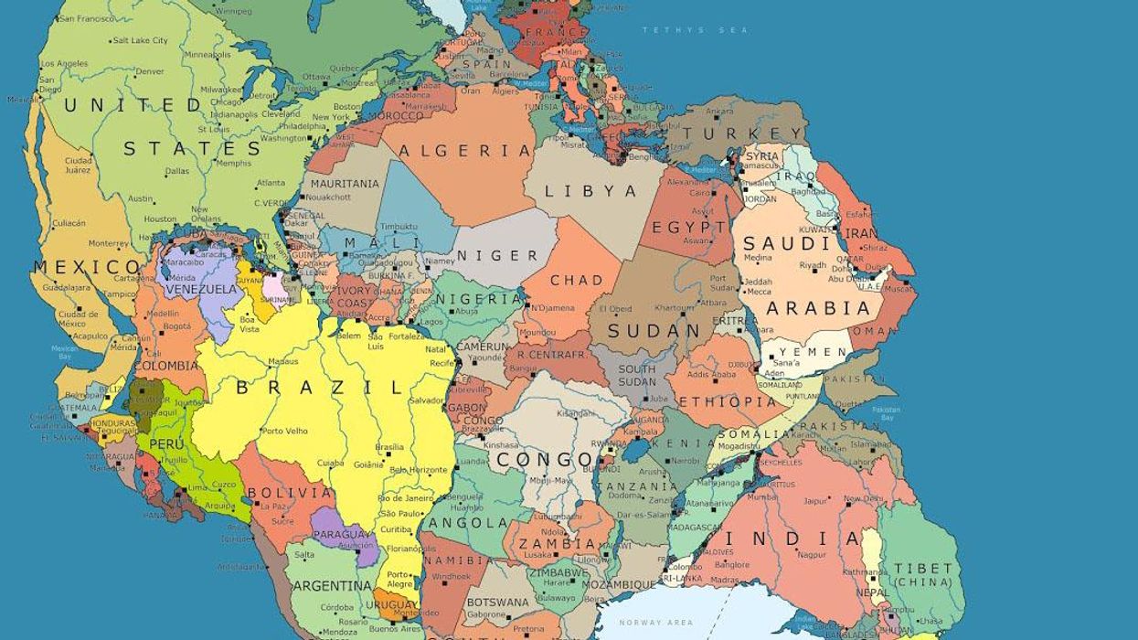
But once upon a time (well, 300 million years ago, to be precise) the world as we know it was pretty much one big continent, where Eurasia, North America, South America, Africa, India, Antarctica and Australia were quite literally joined together as one.
It's believed that this super continent was assembled from earlier continental units approximately 335 million years ago and began to break up about 175 million years ago – and was mostly situated in the southern hemisphere.
Over the passage of time and some very complex science stuff the continent began to break up.
Now an artist, Massimo Pietrobon has created a map with modern political borders - and it's not what you'd expect.
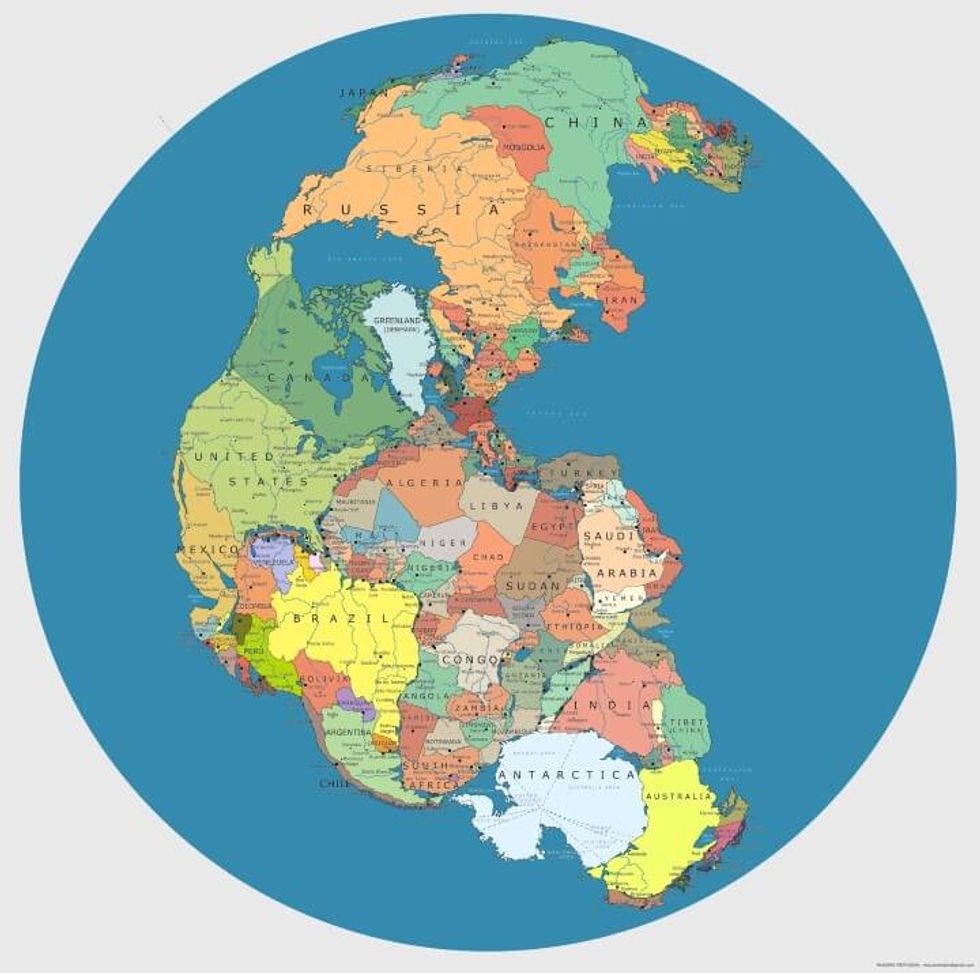
In the map, Great Britain is no longer an island, but has land borders France, Norway and Ireland, and the United States now borders Morocco, Mauritania, Senegal and Cuba.
Canada borders Denmark, Portugal, and Morocco and Spain has a land border with Algeria
Italy borders Tunisia. Greece borders Libya.
Brazil, famous for its beaches is now landlocked and borders Nambia and Liberia among others.
Tibet isn't attached to China anymore, but Australia.
Australia also borders Antarctica, which is next to India, Sri Lanka and Mozambique.
See a zoomable, high-res version of the map here.
Top 100


x